See every angle with Panoramic imagery
Leverage deeper insights from highly detailed, multidirectional panoramic views across your areas of interest.
View from 45º

Pan and zoom

Uncover Insights
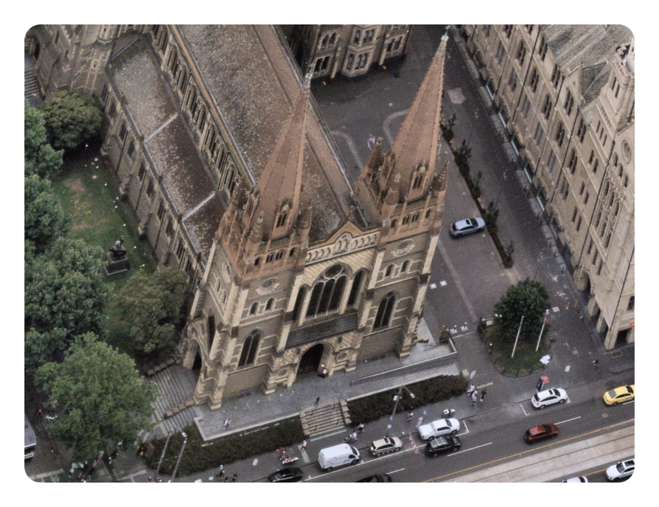
High-resolution panorama aerial imagery
Understand important locations with a view from every cardinal direction. With a more complete picture, make accurate plans and monitor change with confidence.

See more of what’s around
Smoothly pan and zoom from all cardinal directions for a clear 45-degree angle view of details and features.

Gain greater contextual property intelligence
Understand what’s on the ground in more detail with a multi-angle perspective, with regular metropolitan survey updates helping track change over time.


Flexible ways to access Panorama Imagery
Panorama imagery can be used in our MapBrowser and Betterview applications, exported for use in other software, or accessed via APIs.

Powerful use cases
Explore how your industry uses Panorama imagery and other Nearmap products to move the needle:

Looking for the tech specs?
Dive into the details and specifications of Panorama imagery with detailed documentation in the Help Centre.
“Having that level of information before you actually do that first site visit is really important… it’s just so revealing, it’s like being on site, it takes it to another level.”
Spatial Applications Developer, Sydney Water
“If I had to do this job again and I didn't have access to MapBrowser, I don't know what I would do. Having a tool like this means I can get all the detail and information I need, as accurately as possible.”
Senior Project Engineer, Airports & Specialised Pavements, Downer
“The reason that Nearmap matters to us in this journey and as we go along is that all of this starts with their product.”
Chief Executive Officer, Altus Group
“Accenture gets to help build the most advanced solar platform on the planet and work with amazing partners like Origin, Google, and Nearmap.”
Associate Director, Cloud First, Google Business Group at Accenture
“Nearmap has property boundaries, road names, and other useful background data. That means that in many cases, you don’t need to use a GIS program.”
Planner & Scheduler, Veolia Network Services Brisbane
Panorama imagery: multidirectional insights
Government
Empower policy decisions with unparalleled 45-degree angle Panorama imagery.
Architecture & build
Enhance knowledge and perspective from all angles of a structure, assisting in design and construction from your desktop.
Insurance
Accurately assess underwriting risk and claims with a view from all cardinal directions for greater property intelligence.
Solar & roofing
Provide more comprehensive, accurate, and up-to-date plans and quotes with a viewpoint that covers multiple angles.
Utility assets
Inspect assets and their surrounds, including obstructions and damage, from every cardinal angle for more efficient asset maintenance.
Technology
Integrate Nearmap high-resolution aerial imagery into applications and solutions, adding value with multi-angle views.